
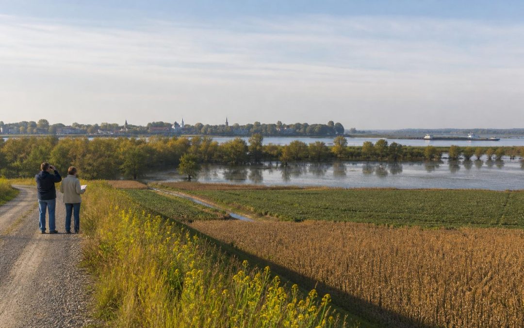
If you are used to the Ozarks or Ouachitas, the Arkansas Delta can take a little time to understand.
There is no rocky overlook waiting around the bend. Roads run straight. The horizon seems impossibly far away. A field can stretch so wide that a grain elevator looks close for ten minutes before you actually reach it.
But here is the secret: mountain scenery asks you to look up, while the Delta asks you to look around.
The beauty is in old river channels, lines of cypress trees, flooded rice fields, distant flocks of snow geese, blues music, courthouse squares, and towns that make more sense once you understand the land around them. The Delta rewards people who slow down and learn to read it.
First, Let the Delta Change Your Idea of Beautiful
The first thing I tell mountain lovers is not to search for the Delta version of a scenic overlook. That is not how this part of Arkansas works.
Instead, notice the sky.
Without mountains or thick forest closing in the view, weather becomes part of the scenery. You can watch clouds build from one end of the horizon to the other. Sunsets spread across entire fields. During migration season, great groups of geese can turn the sky noisy and restless in a matter of seconds.
Then look at the fields themselves. They are not empty spaces between attractions. They are the attraction.
Rice, soybeans, cotton, corn, and winter wheat change the look of eastern Arkansas through the year. Spring brings flooded ground and bright new growth. Summer turns everything intensely green. Harvest season adds combines, cotton modules, dust, and the steady movement of farm trucks. Winter can fill low fields with ducks and geese.
Even the straight roads tell a story. Much of the Delta was surveyed into orderly sections, drained, cleared, and turned into farmland. Those long roads are not boring once you realize you are traveling across land that people have spent generations trying to understand, drain, irrigate, and protect.
Follow the Water to Find the Hidden Landscape
Water explains nearly everything here.
The Mississippi River built this broad plain by flooding, shifting, and leaving soil behind. Smaller rivers, bayous, swamps, and abandoned channels still show where that water went. Levees and drainage ditches show where people wanted it to go instead.
One of the best places to see this relationship is Lake Chicot State Park near Lake Village. Lake Chicot is Arkansas’s largest natural lake, but the detail that makes it fascinating is its shape. It is an old bend of the Mississippi River, cut off from the main channel.
Once you know that, the lake stops looking like an ordinary lake. Its long curve becomes evidence. You are standing beside a piece of the Mississippi’s former route.
Farther north, the wetlands of the Cache River National Wildlife Refuge offer another side of the Delta. Here the landscape closes in around cypress, tupelo, sloughs, and bottomland forest. It feels completely different from the open farm country only a short drive away.
For an especially unusual stop, visit Louisiana Purchase State Park. A boardwalk leads into a headwater swamp to the point from which the Louisiana Purchase lands were first surveyed. It is a tiny park with a huge story.
Here is the part most people miss. The marker is in a swamp because surveyors needed a fixed starting point where two survey lines met. Modern Arkansas property lines still connect back to work that began in this wet, quiet patch of woods.
This is one of my favorite Delta stops because it turns something as ordinary as a property boundary into a reason to walk through an Arkansas swamp.
Do Not Treat Crowley’s Ridge Like a Mountain Substitute
Crowley’s Ridge rises above the surrounding Delta from around Helena West Helena north toward Missouri. If you have been craving hills, it will immediately catch your attention.
But do not think of it merely as the closest thing the Delta has to mountains. The ridge is interesting because it is so different from everything around it. Its higher ground supported forests, roads, farms, and communities above the flood prone plain.
Drive sections of the Crowley’s Ridge Parkway and notice how quickly the landscape changes. One minute you are among open fields. The next you are on a wooded road with curves, slopes, and deep soil piled by ancient winds.
The view from the ridge also helps the Delta make sense. You begin to see why people chose higher ground when water shaped so much of daily life below.
Make Time for the Towns Between the Fields
If you hurry from one nature stop to another, you will miss half the Delta.
Helena West Helena deserves real time. The town sits where Crowley’s Ridge meets the Mississippi River, and that meeting explains its importance. River trade, agriculture, the Civil War, and the blues all come together here.
Explore the Delta Cultural Center when it is open, look for the levee, and pay attention to Cherry Street. Helena’s blues tradition was not imported to entertain visitors. It grew from the communities, churches, farms, radio programs, and musicians of the region. The long running King Biscuit Time radio program is part of that living story.
In the northern Delta, Dyess shows a different chapter. The Dyess Colony was a New Deal agricultural community, and Johnny Cash grew up there. The Johnny Cash Boyhood Home is meaningful even if you are only a casual fan. Seeing the small house and surrounding fields makes his songs about work, hardship, faith, and floods sound more rooted in a real place.
Nearby, Parkin Archeological State Park reveals a much older Delta community. The park preserves the site of a large Native American village along the St. Francis River. The mound and riverbank may look quiet today, but this was once a busy place tied to farming, trade, leadership, and ceremony.
Food matters too. Look for local barbecue, catfish, plate lunches, and tamales, especially in towns where the restaurant parking lot is full before noon. Do not assume the plainest building has the plainest food. In the Delta, that can be a costly mistake.
Build a Delta Day Trip With Room to Notice
The biggest planning mistake is trying to cross all of eastern Arkansas in one day. Distances are longer than they look, and the best moments are often unplanned.
Choose two or three anchors instead:
- Northern Delta: Pair Dyess and Parkin, then follow part of Crowley’s Ridge for a mix of music, archaeology, farmland, and wooded hills.
- Central Delta: Begin around Stuttgart, visit Louisiana Purchase State Park, and continue toward Helena West Helena. This route connects rice country, wetlands, surveying history, and blues.
- Southern Delta: Combine Arkansas Post National Memorial with Lake Chicot State Park. You will see how rivers influenced settlement, conflict, transportation, and wildlife.
Stuttgart is especially rewarding during waterfowl season. Rice agriculture and duck hunting are closely connected here because flooded fields provide food and resting habitat. Even if you never enter a duck blind, winter mornings around Stuttgart can help you understand why this town became so closely tied to waterfowl.
Leave extra time for a county road, a small museum, a river landing, or a flock of birds that suddenly changes your plans. Check hours before visiting historic sites, since some have limited schedules.
Most of all, do not judge the Delta in the first fifteen minutes.
Give your eyes time to adjust. Watch where the trees gather. Notice which towns sit on higher ground. Follow the levees. Look for water in places that appear dry. Listen for the connection between the land and the music.
The Arkansas Delta does not rise up to meet you like a mountain.
It slowly shows you how an entire landscape was built by water, reshaped by people, and turned into one of the most distinctive parts of Arkansas.